Citizen Science Initiatives for Monitoring Local Ecosystems in Ontario
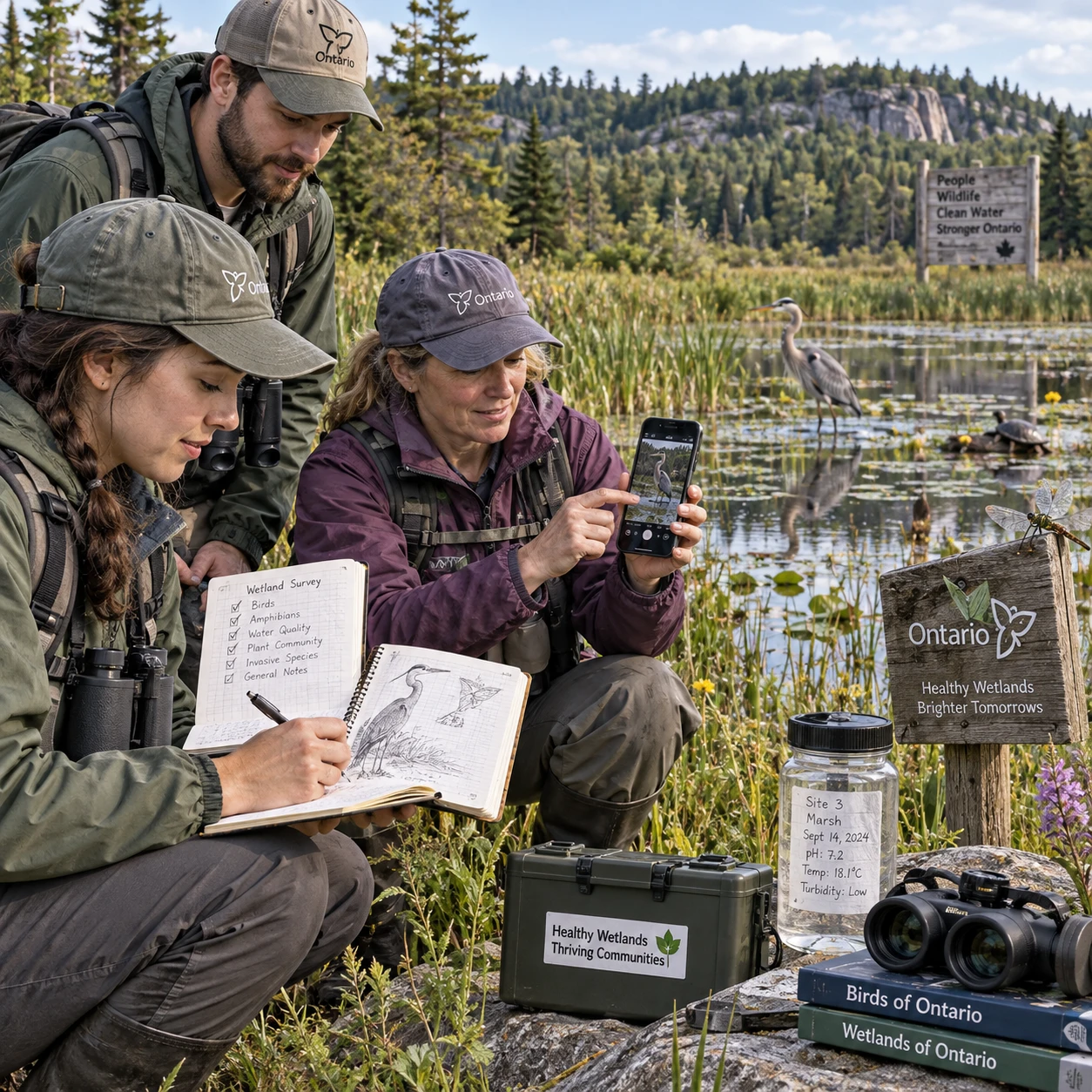
Across Ontario, residents notice changes in the places they walk, paddle, garden, and work: a new plant along a trail, fewer frogs at a pond, or a shoreline altered after a storm. Citizen science initiatives give people a practical way to record these observations and contribute to knowledge of local ecosystems.
With a clear question and consistent methods, community members can help track biodiversity, native and invasive species, water quality, and habitat restoration. Their observations support community-based conservation, while complementing—not replacing—professional ecological assessment.
What citizen science contributes to local conservation
Citizen science invites members of the public to collect or interpret information as part of a defined research or monitoring effort. In local conservation, repeated observations can help show what is present, where it occurs, and how conditions change over time.
A single sighting may be useful, but a series of observations made with the same observation protocols is often more informative. For example, volunteers who visit the same wetland during the same season and record birds in a consistent way can provide a clearer picture than scattered, undocumented reports. Projects may also use photos, measurements, checklists, or structured surveys to improve data quality.
That information can help conservation groups identify questions for further study, choose stewardship priorities, or communicate local concerns. Community observations may reveal where follow-up is needed; they do not, on their own, establish the cause of a change or replace expert surveys. Good projects make that distinction clear and explain how submitted data will be reviewed and used.
For participants, the value is direct: learning to recognize local species and ecosystem features can make conservation feel less abstract. For organizers, public participation can extend monitoring across more sites than a small staff team could visit alone, provided the project has suitable training and quality checks.
What communities can monitor
Communities can monitor species, habitats, and selected environmental conditions, as long as the project uses a method suited to its question. The most useful subject is one volunteers can observe consistently and safely.
Biodiversity and species are common starting points. A project might record seasonal bird sightings, pollinators visiting a garden, amphibian calls near a pond, or plants along a trail. Monitoring can document native species as well as the location and spread of invasive species. Identification can be difficult, so projects should say when a photograph, expert confirmation, or a “likely” identification is appropriate.
Habitat monitoring focuses on the places species depend on. Volunteers may note shoreline condition, tree seedlings in a restoration area, wetland vegetation, or signs of erosion. When a habitat restoration project is underway, repeated records can help document work completed and visible changes, though judging ecological success may require more specialized methods.
Some initiatives track water quality indicators such as temperature, clarity, or selected chemical measures. These readings depend on equipment, sampling technique, and local conditions. A volunteer result is not automatically a regulatory test or a complete assessment of whether water is safe. Follow the project’s instructions and avoid drawing conclusions beyond what its method supports.
- Species: presence, seasonal timing, abundance estimates, or evidence such as tracks and calls.
- Habitat: vegetation, shoreline features, restoration activity, or disturbance.
- Water: specified field measurements collected with approved tools and procedures.
- Invasive plants: location, photographs, and extent, where the project requests these details.
How to find and join an initiative in Ontario
To find a citizen science initiative in Ontario, start with the ecosystem or species you care about, then ask local conservation organizations which projects are active and accepting participants. A quick check of the project’s methods, time commitment, and data-use policy will help you choose a good fit.
Look for opportunities through your local conservation authority, conservation organizations, nature clubs, watershed groups, municipal environmental programs, and universities or colleges. Community gardens and restoration groups may also run monitoring connected to their sites. Availability differs by region and season, so an organization may welcome volunteers for a particular survey but not accept general observations.
Before signing up, check these points:
- Purpose: What question is the project trying to answer, and how will findings be used?
- Method: Does it provide written protocols, training, and support with identification?
- Commitment: Is participation a one-time event, a weekly survey, or a seasonal task?
- Access and safety: Are sites public, and are there requirements for working near water or in remote areas?
- Data handling: Where do observations go, who can access them, and how are uncertain records treated?
If you are new to fieldwork, choose a guided event or a simple observation task first. You do not need to be an ecologist to contribute, but you do need to follow the project’s rules. Some projects accept casual sightings; others use fixed routes, dates, or equipment and cannot combine data collected in different ways.
How to collect useful, reliable observations
To collect reliable observations, follow the project protocol, record the date and location, document what you saw, and submit the information in the requested format. Consistency matters more than collecting a large number of unstructured records.
Start by reading the instructions before visiting a site. Confirm the survey area, timing, duration, equipment, and any limits on what to record. If a project asks volunteers to walk a fixed route for 20 minutes, for instance, changing the route or extending the survey can make the result harder to compare with other visits.
Record the details while you are there: date, start time, location, weather if requested, method, and species or condition observed. Use the project’s preferred location format. A clear photograph can help verify an identification, but avoid handling wildlife or damaging plants to get a better image. Never enter restricted property or sensitive habitat without permission.
When you are unsure, say so. Use the project’s uncertainty options, submit a photo for review if allowed, or leave the identification at a broader level. Guessing a species name can create more work than an incomplete record. For water sampling, use the specified container, calibration, and storage procedure; small inconsistencies can affect measurements.
A useful field-note check is “when, where, how, and what”: when did you observe it, where exactly, how did you survey, and what evidence supports your record? Keeping those four details together makes observations easier to interpret later.
From observations to local action
Community observations support local action by helping groups identify patterns, decide where to investigate further, and explain stewardship priorities. Their influence depends on sound methods, appropriate interpretation, and a clear route from data to decisions.
A cluster of reports about an invasive plant, for example, may prompt a conservation group to verify sites and plan a targeted response. Repeated notes from a restoration area can help coordinators understand where volunteers have worked and where follow-up visits may be useful. A pattern in wildlife observations might guide a more formal survey rather than serve as proof of population change.
Project organizers should share results back with participants in plain language. A short seasonal summary, map, or community meeting can show what was recorded, what remains uncertain, and what happens next. That feedback builds trust and helps volunteers see how careful observation connects to habitat restoration, invasive species management, or watershed stewardship.
There are limits. Uneven participation can leave some neighbourhoods or habitats under-recorded, and reports may reflect where people have access rather than where species are most common. A strong project documents gaps and avoids treating volunteer data as a complete census. When decisions carry regulatory, safety, or major ecological consequences, professional assessment may be needed.
Starting a community monitoring project
To start a community monitoring project, define one answerable question, choose a manageable method, coordinate volunteers, and decide in advance how the data will be checked and used. A small, consistent project is usually more useful than a broad effort with no shared protocol.
Begin with a local concern that can be observed. “Are native plants establishing in this restoration plot?” is more actionable than “Is the ecosystem healthy?” Set a practical boundary: one park, shoreline, stream reach, or season. Then ask a conservation authority, local ecologist, watershed organization, or experienced community group to review the question and method.
Next, design the protocol. Specify where and when to survey, what volunteers should record, what tools they need, how to handle uncertain observations, and how to submit results. Keep training proportional to the task. A photo-based plant record needs different instruction from water sampling or amphibian call surveys.
Before recruiting, confirm site permissions, safety procedures, accessibility, data storage, and a contact person for questions. Assign a coordinator to check incoming records and communicate updates. If the project spans multiple seasons, plan for volunteer turnover and store protocols where new participants can find them.
- Define the question: Make it specific enough to guide a decision or next step.
- Choose the method: Match effort and expertise to the subject being monitored.
- Prepare volunteers: Provide a brief training session, field sheet, and safety guidance.
- Plan data use: Decide who reviews records, where results are shared, and what limitations will be reported.
Keep the first season modest. Review what worked, where data were incomplete, and whether the results answered the original question. Adjust the protocol carefully and document changes; otherwise, records from different years may no longer be comparable.
Frequently asked questions
Citizen science is open to people who can follow a project’s instructions, and many local monitoring tasks require no previous ecological training. The right project and method depend on what you want to observe and where you live.
What is citizen science, and who can take part?
Citizen science involves public participation in research or monitoring. Students, families, experienced naturalists, and first-time volunteers can all take part when a project’s training, access, and safety requirements suit them.
What can volunteers monitor in their local ecosystem?
Depending on the project, volunteers can record biodiversity, native or invasive species, habitat conditions, restoration activity, or selected water quality measures. Follow the project’s scope rather than collecting extra information it cannot use.
How can I find a citizen science project near me in Ontario?
Contact your local conservation authority, watershed group, nature club, conservation organization, or municipal environmental office. Ask what is active in your area, whether volunteers are being trained, and how observations are used.
How can volunteers make observations more reliable?
Use the same protocol as other participants, record dates and locations accurately, include requested documentation, and mark uncertain identifications honestly. Do not change survey methods without asking the project lead.
Can a community start its own monitoring initiative?
Yes. A community can start a project by defining a focused question, selecting a repeatable method, arranging permissions and safety measures, and planning how someone will review and use the data. Consult local ecological expertise when the question or decisions require it.